Blog Archives
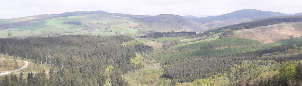
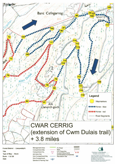
Cwar Cerrig
Try this extension to the Cwm Dulais trail climbing over higher ground with great views before descending by the stone quarry.
 Cwar Cerrig Trail Map (632.6 KiB)
Cwm Dulais & Cwar Cerrig Trail Map (2.2 MiB)
Cwar Cerrig Trail Map (632.6 KiB)
Cwm Dulais & Cwar Cerrig Trail Map (2.2 MiB)


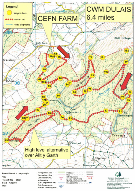
Cwm Dulais
Enjoy the views of wooded Cwm Dulais and try to stay dry when passing through the three fords.
This route can be extended by using the Cwar Cerrig Trail from point 73 and rejoining at point 79. This makes the total route 8.6 miles.
Cwm Dulais Trail Map (693.8 KiB)
 Cwm Dulais Horse Riding Trail GPX file (27.0 KiB)
List
Cwm Crychan - CFA - Horse Trail
Profile
Description
Trail 11 Cwm Dulais
Profile
Description
Cwm Dulais Trail Map (693.8 KiB)


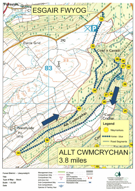
Allt Cwmcrychan
Take in the long views over open pastures and drop down into Cwm Crychan, before climbing out of the valley along the forest road.
Allt Cwmcrychan Trail Map (659.2 KiB)
Allt Cwmcrychan Trail Map (659.2 KiB)


Cwm Crychan
Trail Map shows the new layout at Brynffo car park
Take the winding tracks through the forest to the Cwm Crychan viewpoint, with amazing views over the lower Tywi valley. Here you will find a hitching rail and picnic table.
Trail 10 Cwm Crychan - Map (1.1 MiB)
Cwm Crychan - CFA - Horse Trail - GPX file (13.7 KiB)
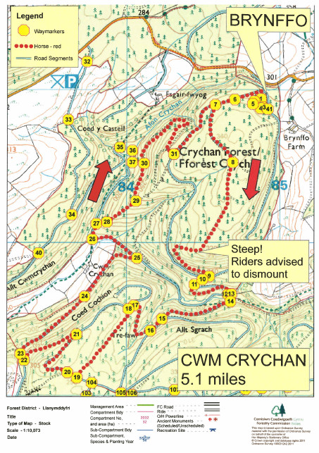

Trail 10 Cwm Crychan - Map (1.1 MiB)
Activities in the Forest
Nicky Grist Stages 2025
Saturday 12th July 2025
www.nickygriststages.co.uk
Open access to the forest will be suspended during this motor sport event.
Roger Albert Clark Rally 2025
Thursday 20th and Friday 21sth November 2025
Website: http://racrmc.org/
Open access to the forest will be suspended during this motor sport event.